Physical Map of China
Home ![]() China Facts
China Facts ![]() Physical Map of China
Physical Map of China
A map of the world or a large area is often either a 'political' or 'physical' map.
The most important purpose of the political maps is to show territorial borders; the purpose of physical maps is to show geographic features, depicting physical features that presents on the earth's surface, such as various landforms and water bodies.
Geological maps show not only the physical surface, but also characteristics of the subsurface structures, underlying rock, and fault lines, etc.
Colors play an important role in physical maps and are used dramatically to distinguish landforms and elevations depicted on the map.
Different lines, tints, shading and spot elevations are also used.
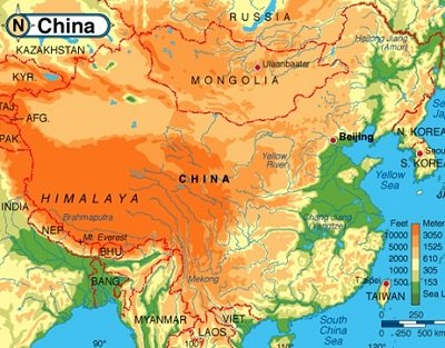
Here is a physical elevation map of China:
 China physical map: elevation
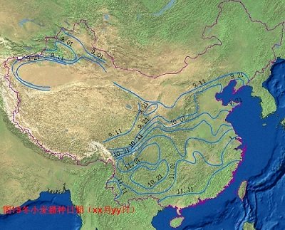
Here is a physical map to show the date of wheat planting in China:

Click here to see the features of China from satellite.
More China Facts:
- China Today Facts
- The Great Wall of China Facts
- China Facts about History
- China Facts for Kids
- Chinese Language facts
- China Facts about its land and sea

New York Pass With More than 50 Sttractions

Southern California CityPASS saves you 32% for Disneyland, Universal Studios and 3 other attractions


